
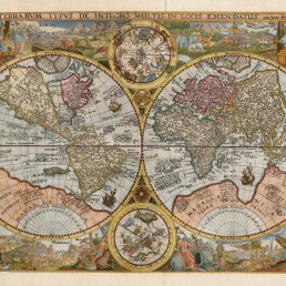
Name/TitleChart of New South Wales and Van Diemen’s Land
About this objectMap by the mysterious female cartographer Jehoshaphat Aspin is one of the earliest obtainable separate maps
of New South Sales, Australia, to illustrate the explorations undertaken by John Oxley and George Evans between 1817 and 1818.
Cartographically this map is derived from the Oxley / Arrowsmith map of 1822. Roughly centered on Sydney, the map covers the coast from
the Solitary Islands (north of Port Macquarie) to Cape Howe. It extends inland along the Lachlan River to its apparent marshy source. It also
extends along the Macquarie River as far north as Mt. Forerster and Mt. Harris. Major roadways are highlighted.
A secondary map focusing on Tasmania or Van Diemen's Land appears in the lower right quadrant. Though the island is largely unexplored at
this point, the chart includes a detail of the roadway between Hobart Town and George Town. Tertiary maps illustrate the vicinity of Port
Jackson and Sydney, as well as provide a general overview of the Australian continent.
Jehoshaphat Aspin (fl. c. 1805 - c. 1832) was a British author, humorist, historian, and geographer active in the early 19th century. Aspin is
a bit of a mystery, but the name believed to be a nom-de-plume for an unknown female author. Aspin produced a number of children's
books, geographies, geographical games, and histories. Her primary work Cosmorama focuses on connections between culturally and geo‐
graphically disparate peoples, for example, comparing Italian and Malay. Cartographically she appears to have worked with John
Thompson, Matthew Carey, and C. V. Lavoisne.
Source: https://www.geographicus.com/P/AntiqueMap/newsouthwalestasmania-aspinjehoshaphat-1827
MakerJehoshaphat Aspin - Author/Maker
Maker RoleAuthor/Maker
MakerJohn Thompson - Publisher
Maker RolePublisher
Date Made1827
Period19th century
Place MadeAustralia
Place MadeLondon, United Kingdom
Place NotesPublished
Medium and MaterialsBlack printing ink; pigment. Paper.
Measurements550mm x 730mm
Object TypeMaps and Charts
Object numberSF000045
Copyright Licence![]() Attribution - Non-commercial - No Derivatives (cc)
Attribution - Non-commercial - No Derivatives (cc)
Explore by category
Maps and Charts
Date range: 1541-1836

Ship Models
Date range: 1629-1890

Maritime Paintings
Date range: 1793-1849

Manuscripts and Ephemera
Date range: 1768-c1850
Medallions & Convict Tokens
Date range: 1619-1880


Indigenous History
Date range: c1800-1959

Landscapes
Date range: 1768-c1850
Books
Date range: 1694-c1850

Currency and Shares
Date range: 1624-1823

Printed Material
Date range: 1541-1836
Maritime Archaeology
Date range: 1629-1854


Curator's corner
New acquisitions, staff favourites and curios
The mug is decorated with an underglaze and a blue transfer print. On the body, it is titled ‘Emigrants to Australia’. This type of body and glaze was discontinued by 1840. Comparison of the handle shape and the profile of the foot, point to the attribution of manufacture by the Davenport Factory.

Delta was a ship-rigged vessel with two decks and three masts. It was built in Dordrecht, Netherlands in 1839 at the shipyard of Jan Schouten and registered in the same port. Its hull was constructed of oak and sheathed in ‘yellow metal’. Delta was owned by H. van der Sande at the time of its loss and was engaged as a cargo trader.
The Delta carried 29 crew and passengers, while sailing from Melbourne to Batavia in ballast when wrecked at Kenn Reefs on 30 May 1854 whilst under the command of Captain J.G. Kunst. This vessel loss supports the pattern of shipwrecks located on a well-travelled shipping route that was poorly charted until the mid-nineteenth century. The crew of the Delta could see four other shipwrecks at Kenn Reefs at the time of their vessel’s loss.

Important image of a ship associated with Matthew Flinders, that would shortly become one of the most famous early shipwrecks in eastern Australian waters. This is a fine ship’s portrait, by one of the great exponents of the art